
Rock Hill Previous Residents Sources
Different sources place past residents at different points in time. York County property and deed material usually begins the trail because it supplies a parcel and legal description. Rock Hill city and telephone directories add a dated address or phone association. Census material describes a household at the time of enumeration, while Sanborn maps date the block and building context rather than a person. The strongest backward trail compares these sources instead of treating any one result as a complete history.
| Source | Years it covers | Where held | What it contributes |
|---|---|---|---|
| York ROD online index | After July 1982 | York County Register of Deeds | Recorded land-instrument index and document context |
| ROD books and indexes | Earlier records beyond the web cutoff | ROD office in York | Grantor/grantee books, plats, deed books, and microfilm |
| Rock Hill city directories | 1913-2026 inclusive, 121 volumes | Louise Pettus Archives | Dated address and telephone associations |
| Sanborn map sequence | 1884-1916 and 1926/1949 pages | City preservation links | Street layout, footprint, and building-use context |
| City permit records | No citywide online start year verified | Planning & Development map, portal, reports, or FOIA | Construction or project chronology, not occupancy evidence |
| Federal census | 1790-1950 publicly released | Library and national research channels | Household at an enumeration date |
Start with the newest parcel when the house is still identifiable. If the question reaches an earlier street pattern, move to the deed books, maps, and archive directories. A missing online result is a reason to change access channels, not proof that earlier records never existed.
Note: Record the repository, edition, book/page reference, and exact date with every past-resident clue so later comparisons remain testable.
Rock Hill Past Residents Maps
The first job is to normalize the address. Use the York County Assessor's property search or One Map to save the physical address, TaxMap ID, legal description, and jurisdiction. The Assessor's verified search choices are Address, TaxMapID, and Owner Name. Address mode has House Number and Street Name fields. One Map can be searched by address, Tax Map ID, or subdivision, making it a useful second check when a historic street spelling or parcel split complicates the address.
Keep the situs address, tax mailing address if shown on a specific record, and legal description in separate notes. A situs address identifies the land's physical location. A legal description identifies the tract or lot across changes in street numbering or city growth. A mailing address is for notices and may point somewhere else. That distinction keeps the previous-residents trail tied to the right property.
Note: Save the TaxMap ID and legal description before changing sources because they remain useful when the street address changes form.
- Situs address
- The physical location of a parcel. It is the address to compare with a map or period directory.
- Tax-map number
- A county parcel identifier that helps connect an address to an assessment record and land-record research.
- Legal description
- The deed's land description, often using a lot, block, subdivision, plat, or other land reference rather than a street address.
- Plat
- A recorded map that can link a lot or subdivision description to the property trail.
Rock Hill Previous Residents Deeds
A chain of title is the sequence of recorded transfers for one piece of land. It is the owner side of a previous-residents search, not a full list of the people who lived at the address. Begin with the current property record, then locate the owner's acquisition as a grantee in the ROD index. The seller on that instrument becomes the name to search as a grantee in an earlier transfer. Follow deed references, plats, and legal descriptions rather than relying only on the modern street number.
- Open the property card or One Map parcel and copy the TaxMap ID and legal description.
- Search the current recorded owner as a grantee in the ROD Name Search. Confirm the address clues, deed type, filing date, and book/page or instrument number.
- Read the instrument details for the grantor, grantee, legal description, subdivision fields, and cross-references. A grantor transfers an interest; a grantee receives it.
- Search the prior grantor as a grantee to identify that party's acquisition. Repeat the process while noting every transfer and date.
- When the web trail reaches its limit, ask the ROD office for the earlier grantor/grantee books, deed books, plats, and microfilm. Do not replace a missing deed with an assumption about a past household.
A trust, estate, company, or representative on an instrument needs an additional record check. An estate name can lead to York Probate, and a plat reference can lead to a subdivision history. Neither automatically identifies a resident.
Rock Hill Past Residents Search
The York ROD Name Search supports Grantor and Grantee criteria, a default option to search either role, optional start and end dates, Both/Company/Human entity filtering, and date or name sorting. The portal normalizes name searching by stripping spaces and punctuation. Its first output is capped at 2,000 results, so a date range or document category is important when a name is broad. Book/Page or File Number and Property Description searches are useful when a deed gives a lot, block, map, phase, unit, or subdivision reference.
See the official York County ROD Name Search before beginning the grantee-to-grantor sequence.
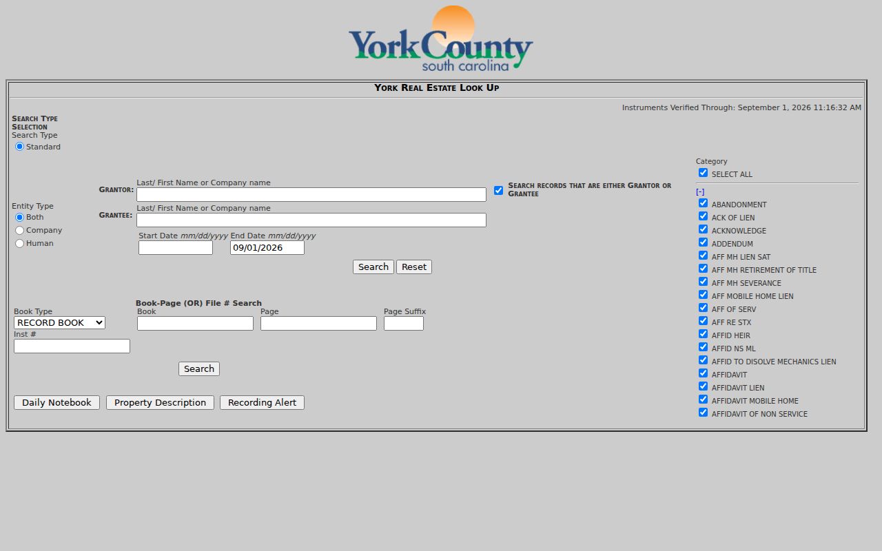
The result path begins with Name Pick and then a Grantor-Grantee index. Detail records can show an instrument number, permanent-index status, filing time, party table, legal description, subdivision fields, cross-references, and image indicator. Read the specific document before treating an indexed name as a property connection.
Note: Narrow a common name by date, document category, or property description before relying on any index result.
Rock Hill Past Residents Handoff
York County's online access is only one segment of a longer record path. The county says documents recorded after July 1982 are online. The Historical Center of York County describes a backward-deed route of microfilm from 1785 through 1977, a practical ROD-office bridge for 1977 through 1983, and online ROD material after 1982 or 1983 depending on the source description. Preserve both dates as access guidance, then ask the ROD about every transition year rather than assuming a clean handoff.
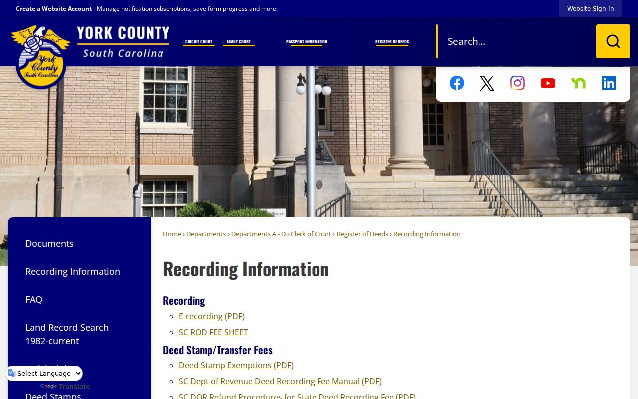
For the office procedure and current recording resources, consult York County ROD Recording Information.
The historical route adds useful fallbacks. The Historical Center of York County has deed microfilm, maps, newspapers, and courthouse materials. York County Library provides land, will, estate, census, and local-history sources. FamilySearch access through the library and South Carolina Department of Archives and History research tools can help locate older county material, but each repository should be cited for the exact item used.
Rock Hill Previous Residents Geography
Address history changes with city growth. The 1947 annexations of Catawba Terrace, Mount Gallant Farms, Finley Road, and East Main Street increased Rock Hill's area by 67 percent. A past address may therefore appear in a different municipal or postal context from its present parcel. The right response is to compare the contemporary map, the period directory spelling, and the legal description, then see whether a plat or historic survey bridges the two records.
Rock Hill's preservation resources link an 1891 city map, historic surveys, and Sanborn material from 1884 through the 1926/1949 sequence. The maps can date a block's street pattern, building footprint, and nearby uses. They cannot establish a person's identity. Pages 40 through 42 are noted as missing from the 1926/1949 listing, so document that gap rather than filling it with a neighboring page.
No authoritative citywide renumbering year was found. If an old address does not fit the current map, retain the original text and test it against the period map, subdivision or plat, tax-map number, and Rock Hill Historic Preservation material.
Rock Hill Previous Residents Directories
Louise Pettus Archives and Special Collections holds Rock Hill City Directories, Accession 89, an open collection of 121 bound city and telephone volumes with inclusive dates of 1913 through 2026. The collection-level record verifies address and phone listings for people, businesses, churches, and other establishments. It does not prove every annual issue survives, and no particular entry image was verified for fields such as a spouse notation or an owner marker. Copy only what the edition actually prints.
The York County Cross Reference Directory is the address-to-name bridge. The 1968 volume includes street and numerical-phone sections. Read the street section for the address, copy the printed subscriber or listing exactly, then look in the forward directory for that name. Compare prior and later volumes before drawing a conclusion about a move. The detailed archive holdings belong with the Rock Hill directory book; use them here as dated evidence in one address trail.
When the directory sequence stops, York County Library's Main Library Local History Area is a direct in-library fallback for local newspapers, marriage and death notices, cemetery and church indexes, and census microfilm. Its YCHistory project adds selected newspaper and community indexes, but an index hit may point to source material rather than display a full item.
Rock Hill Previous Residents Census
Directories and census schedules capture different moments. A directory connects an address, phone, or listing to a particular edition. The federal decennial census records a household at its enumeration date. As of the research date, 1950 is the latest publicly released decennial census because of the 72-year restriction. Pair a directory volume just before or after a census year with the actual census image or transcription, then compare the address, initials, age context, and enumeration district carefully.
- Choose the directory edition closest to the period being studied and copy the address and exact name spelling.
- Check the preceding and following available directories. A gap in the archive run is not proof of a move.
- Use the city street listing or 1968 cross-reference entry to test the address association for that edition.
- Locate the appropriate census record through York County Library's census materials or its in-library research services, then compare the actual household date with the directory date.
- Use a deed, map, obituary, or estate record to explain a change only after the dates and location align.
Census residence, directory subscription, property ownership, and mail delivery are not interchangeable. A person can appear in one and not another. The comparison is strongest when the source dates, printed address, and parcel description support the same conclusion.
Note: Treat each source as a dated observation, then use a second independent record before naming an address connection as likely.
Rock Hill Previous Residents Estates
An estate record can close or clarify an address trail. York Probate provides an online search for estates from 1975 through current, refreshed each evening. Search by decedent name or case number, and use the exact spelling used by the estate record. Results can identify the case number, case name, party, case type, filing date, county, appointment date, creditor-claim due date, and case status. That makes it a careful route for family-history or heir research when a deed refers to an estate or a directory trail ends near a death.
York Probate says post-filing documents may be viewed without charge the next day and printed for $2 per document. Estate and marriage-license material is also available on public computers in the ROD office. Pair an estate lead with a library newspaper or death notice, the City cemetery search with its incomplete-listing warning, and a relevant historic directory. Each source helps distinguish a move from a death, a changed name, or a same-name coincidence.
For older county context, the Historical Center's records include will books, inventories and appraisals, Equity Court records, minute books, and microfilm deed books. Search both York District and York County for older material because the jurisdiction name changed after South Carolina's 1868 constitutional transition.
Rock Hill Previous Residents Limits
Previous residents research is a record trail, not a way to build a profile of living people. A deed identifies parties to a recorded transfer. A directory identifies a printed address or phone association for one edition. A census reflects an enumeration date. A map describes the block or building. These sources leave gaps, and they can conflict. The right result may be a narrower conclusion such as an owner at a recorded date or a listed subscriber in a directory year.
South Carolina's Address Confidentiality Program protects qualifying participants through a substitute-address system. Qualifying judges and certified law-enforcement officers may also seek removal of specified personal data from government websites. Public records can be redacted, sealed, delayed, or held only at the custodian's counter. An absent result never proves that an address had no occupants.
Lawful use. Use Rock Hill previous-residents records for family history, estate research, property history, and other lawful personal purposes. Do not use an address trail to stalk, harass, intimidate, or harm anyone.
For an apparent record error, contact the office that created it: Assessor or GIS for parcel data, ROD for recorded land material, Planning & Development for a City permit file, and the archive or library for a historical source. South Carolina law also restricts the use of public-record personal information for commercial solicitation.